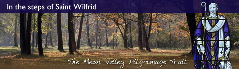
Section 2 - Titchfield Church
to Wickham Church
Introduction
This walk of about 6½ miles (10 km) takes us out of
Titchfield, passes the Abbey, crosses several roads and
involves climbing over numerous stiles. It provides glimpses
of the River Meon - and of fast roads! It takes about 3 hours.
Parking
As you enter the village from the A27, turn right into a small road which leads to the Community Centre where there is plenty of free parking. Opposite the beginning of this small road, there is a sign "Church Path" which takes you through the churchyard to the Church. St Peter's is an impressive building which could have been founded by St Wilfrid in 680 (there are certainly similarities with other churches in Northumbria) and there are important Saxon remains both of Wilfrid's original church and of the 11th C rebuild. The Church, which is open during the day and has explanatory leaflets, contains much of interest including a fine tomb of one of the Earls of Southampton.
The Walk
Start at the Church and walk up Church Street into The Square, where there are several good pubs and shops. Passing the "Queens Head" on your left, go straight on into a small alley; this becomes a path which runs along the back of the Community Centre where you may have parked. This brings you to the busy A27; cross straight over, taking great care! (Alternatively, turn right down the road so as to cross at the traffic lights; go up Titchfield Lane and rejoin the walk at the "Fisherman's Rest"). On the other side of the road you will find a path. Go over a stile, and along a track through a sports area.
(There is a good view of the 13th century Titchfield Abbey which, after the Dissolution, became the home of the Earls of Southampton. The 3rd Earl was a patron of Shakespeare who is believed to have written "Love's Labour's Lost" while staying in the Abbey. The 15th century timber-framed Tithe Barn is said to have been the setting for the first performance of "Romeo and Juliet")
Cross another track; after 50 yards, turn right and go down the lane passing the Abbey Garden Centre to the main road, which is Titchfield Lane; turn left. Across the road is the "Fisherman's Rest", which is recommended. On your left is the Gateway to the Abbey, where times of opening are displayed. Cross the road and go down Fisher's Hill, over the River Meon; after 50 yards, turn left into a Bridleway by Abbey Farm. This is a pleasant tree-lined lane which goes under a railway bridge, and passes the Henry Cort School buildings and its all-weather sports pitches. After about ½ mile, at some tile-coated white cottages on the left, bear left and go past "Fareham Park Cottages". This brings us to a housing estate: go straight on along a lane for ½ mile to a road, and turn half left to join a Bridleway which leads to the M27 (with much car noise!). Go down some concrete steps and under the motorway.
Immediately after the subway, turn left and walk beside the M27 for 150 yards. Beside a gate, the wooded path turns right, away from the motorway, towards a paddock. Fork left, then turn right, passing "Ironmill House". On entering a farmyard, turn left along a tarmac lane. At the river, look right to see an artificial lake - this is the site of the old Funtley ironworks - and continue on, passing "Ironmaster's House".
(The first record of an ironworks on this site was in the 16th century. Henry Cort (1740 - 1800) built up a foundry here and became one of the greatest innovators of the Industrial Revolution. He also introduced "puddling": a process of packing clay at the bottom and sides of canals, so that they did not leak)
After about 150 yards, look out for a Footpath sign on the right; climb over a stile and follow the footpath through a copse. Following the yellow arrows, climb over a stile and go through a paddock, then over another stile and through a market gardener's junk yard, and over several more stiles and through paddocks (patting friendly horses). Keep following the yellow arrows through several fields, towards Knowle Hospital on the skyline. Eventually, you come to a field beside the rather small River Meon: keep straight on, as the footpath goes through a gap in a hawthorn thicket on the far side of the field. Over yet another stile, you come to a small road which crosses the river by a bridge and joins a major road, Titchfield Lane, at a T-junction on your left.
Cross the small road and go straight on, keeping to the wide verge beside Titchfield Lane, for about 250 yards. On approaching a farmhouse (Great Funtley Farm), turn right through a steel kissing gate; follow the drive which passes a lovely white house (Funtley Mill), and cross the wooden footbridge over the river. The path then rises through woodland to emerge at Mayles Lane; turn left towards Knowle Village.
(The original Knowle Hospital was a large Victorian mental institution. Recently, it and its grounds have been developed to form a new village, Knowle Village, with about 300 houses and apartments. Walkers choosing to keep to Mayles Lane will pass the hospital cemetery on the left; this was recently restored with a woodland walk, and it contains the graves of over 5500 patients and staff who died in the 100 years of the hospital's existence)
Our walk takes us round this new village
Continue along this road for about 150 yards, and then turn right (Footpath) on to a footbridge over a deep railway cutting (single electric line: Fareham, Botley, Southampton). There are yellow footpath arrows. Immediately after the bridge, turn right along a narrow path for about 100 yards. At the end, when faced with the choice of two stiles, turn left and follow the well-signed footpath along the edge of a field for about 700 yards. Turn left again at the next stile and follow this field edge for another 700 yards. Cross the village access road and take the path (yellow arrow) leading into a wood. After 40 yards, bear right; then after 100 yards, at a track junction, turn left and follow the broad path beside a barbed wire fence and passing an electricity pylon. Rejoin Mayles Lane at a kissing gate and turn right along it, for about 950 yards (1km) to Wickham.
Cross the main road and turn left under the railway bridge. There is now a choice: the village, or the water-meadows. For the village, continue on up a slight rise to enter the 13th century Wickham Square where there are pubs and shops. If you have done this, you can continue to the end of the Square and turn right; go down a hill passing lovely old houses; cross the bridge over the River Meon, and there in front of you is the Church across the other side of the busy A32.
Otherwise, cross the main road and join a path (signposted Water Meadows) running beside the river. This gravelled path crosses the river by a bridge and climbs the steps leading up on to the embankment of the disused Meon Valley railway. Turn left along this embankment and at the first bridge leave the track by the steps on the right, in order to visit Wickham Church.
(The Church of St Nicholas is normally open during the day Monday - Saturday, and for Sunday services. Parts of the building date back to 1120. There are historic paintings and monuments, and a memorial to William of Wykeham, Bishop of Winchester, Founder of Winchester College, and Chancellor of England. There are guide books.
Total for Section 2: 6½ miles, allow 3 hours for a leisurely pace.
|